
Lhasa to Mount Kailash: Distance, Road Condition, Best Way to Go
 1. How Far is Lhasa to Mount Kailash? The Location and Routes Map of Lhasa to Mt. Kailash
 2. The Road Condition of Lhasa to Mount Kailash: Southern VS Northern Route
 3. The Most Popular Way from Lhasa to Mt. Kailash is: Southern Route Via Mt. Everest
 5. The Most Adventurous Way from Lhasa to Mt. Kailash is: Northern Route Via Namtso Lake
 6. The Fastest Way from Lhasa to Mt.Kailash is by Flight: Only Two Hours
Mount Kailash, located in the far west of Tibet, is around 1,600 to 1,800 km away from Lhasa depending on the route you choose. The southern route and the northern route to Mount Kailash from Lhasa have differences in distance, road conditions, and on-the-way scenery, which appeal to different tourist groups.
Since both overland routes take over two weeks, there is also a flight to Mt. Kailash that can be an alternative for tourists on a tight schedule.
How to find the best way to go? What to experience on route? Here, we offer you the ultimate guide to get fully prepared for your Mount Kailash tour from Lhasa.
1. How Far is Lhasa to Mount Kailash? The Location and Routes Map of Lhasa to Mt. Kailash
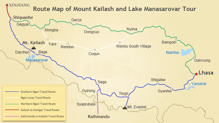
(Simple click to enlarge the map)
Lhasa to Kailash Oveland Route Map
The driving distance from Lhasa to Mount Kailash is around 1,600 km via the southern route and 1,832 km through the northern route.
Starting from Lhasa, the southern route to Mount Kailash travels west along the G318 National Highway to the city of Shigatse. From there, it is southwest to the Everest Base Camp. The remaining journey is a northwest trip, passing through Saga on the way to Darchen, the small town at the foot of Mount Kailash. It is the shortest and the most popular route to Mount Kailash from Lhasa.
The northern route from Lhasa to Mount Kailash starts with a swing to the northwest through the Namtso Lake area. The route continues northwest through Baingoin to Nyima before turning southwest to continue through Coqen to Zhongba. The final leg is northwest to Darchen at the foot of Mount Kailash.
2. The Road Condition of Lhasa to Mount Kailash: Southern VS Northern Route
The Mount Kailash road condition for the southern route is quite good except for some sections when it's raining or in winter. A paved highway lies between Lhasa and Shigatse for an utterly smooth drive. From Shigatse through Tingri to Everest Base Camp, the good conditions continue.
Leaving EBC to Saga County the roads are mostly paved. There are many fuel stations and small retail stores along the way. The final stretch to Mount Kailash is also well-maintained, with no rough or bumpy sections.
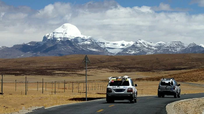
The road condition of overland route from Lhasa to Mount Kailash is quite good.
The road condition of the north route is inferior to the south one. Most sections of the road from Lhasa to Kailash are gravel-paved roads with bumpy and rough surfaces. Only four-wheel drive vehicles can deal with the situations that can come up along the route.
Lhasa to Namtso Lake is a smooth drive along a paved road. However, the road from Namtso to Baingoin is a little bumpy and can get muddy in the rain. Most of the rest of the journey is along gravel or dirt roads. Rain can make for difficult or slow driving conditions.
3. The Most Popular Way from Lhasa to Mt. Kailash is: Southern Route Via Mt. Everest
Chosen by 95% of tourists, the southern route is the most popular route from Lhasa to Kailash. The entire route can be divided into four stretches.
1) Lhasa - Shigatse (270km; Perfect G318 Friendship Highway)
Leaving Lhasa, you follow the G318 Friendship Highway westwards on a completely reliable road. The asphalt-covered road during this section ensures smooth road conditions with no bumpy road surfaces.
However, speed traps are set up along the entire road, which results in slowing down the journey and taking more than 5 hours to cover this part of the route.
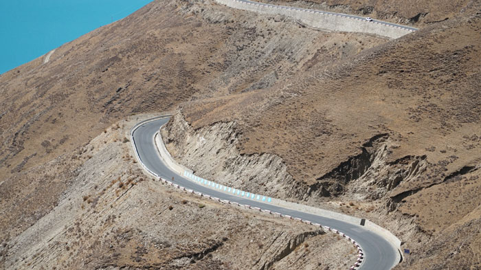
G318 Friendship Highway, perfect road condition only with intermittent speed limits
2) Shigatse - Tingri - Everest Base Camp (363km; Good G318 Friendship Highway)
Leaving Shigatse, the road conditions remain perfect since you continue to follow G318 Friendship Highway until you reach Tingri County after a 243 km drive. This also means the majority of the roads from Lhasa to Everest Base Camp are in ideal driving condition.
Roads change after leaving Tingri County for Everest Base Camp. You’ll take a southward drive to Rongbuk Monastery, which is located 8 km away from the north side of Everest Base Camp. The winding and asphalt-paved hillside road makes your journey comfortable and worry-free.
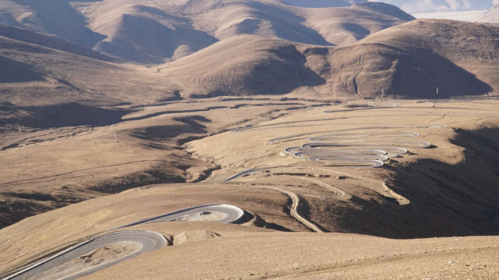
Asphalt winding mountain road from Tingri to Everest Base Camp
3) Everest Base Camp - Saga County (340km; Asphalt Covered Road)
After the once-in-a-lifetime visit to Everest Base Camp, it's time to leave Everest Base Camp and head for Kailash by heading to Saga county, which is widely considered the portal of Ngari prefecture, for it has served as the transportation junction as well as the transfer station for food and materials for quite a long time.
Fuel stations, retail stores, and other repair shops do business here, providing indispensable goods and services for travelers and tourist buses heading westwards. So check everything and get fully prepared before going westwards.
Most of the road sections are paved with asphalt from Everest Base Camp to Saga County, so the road condition is never as bad as you might think.
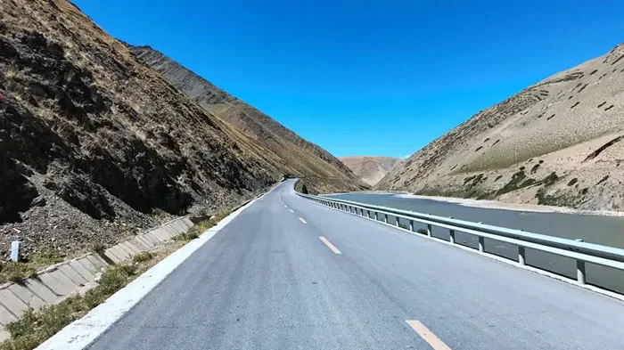
The road from Everest Base Camp to Saga county is well-paved.
4) Saga County - Mt. Kailash (638km; Perfect State Road 219)
Leaving Saga County, we begin to follow State Road 219 and head northwest. The road to Mount Kailash is well paved with neither rough road sections nor bumpy road surfaces. In fact, the entire journey has perfect road conditions.
4. The Best Way from Lhasa to Mt.Kailash is: 15 Days Overland Tour - Pilgrim's Final Fantasy & Greatest Overland Trip
The ultimate Lhasa to Mount Kailash tour is our 15 Days Kailash and Manasarovar Small Group Tour. It is an amazing overland journey through the highlights of Tibet with an adventurous trekking experience at the sacred Mount Kailash.
Starting in Lhasa, you will visit the city's most interesting sites while adjusting to the high altitude. Not only will you see Drepung Monastery, Barkor Street, Sera Monastery, Jokang Temple, and the iconic Potala Palace, but you will also have time to sip traditional tea at a Tibetan tea house to experience real local life.
Driving over the Gampala Pass at 4,790m, you'll see Yamdrok Lake surrounded by snow-capped mountains. Before arriving at Shigatse to stop overnight, you can enjoy Korola Glacier, the largest in Tibet, and take photos of the ancient city of Gyantse.
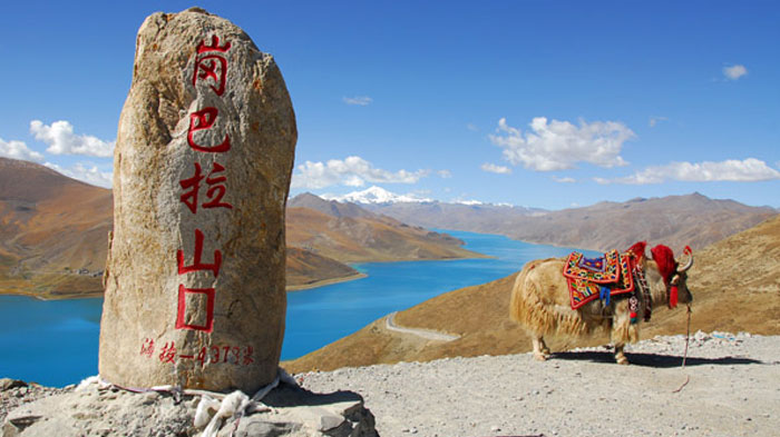
The Gampala Pass and the beautiful Yamdrok Lake are in sight
From Shigatse, it's onward to Mount Everest National Nature Reserve and the panoramic views of the Himalayas at Gawula Pass. You'll arrive at Everest Base Camp to catch the sunset at the towering giant and be able to see the glittering Milky Way as you stay overnight.
At 5,154m, Rongbuk Monastery awaits on the following day before entering the Ngari Region. There, you will see Mount Shishabangma, one of the towering giants, standing at over 8,000m.
In the last stretch before Darchen, you might see herds of yak and sheep in the grasslands of the Saga Valley. When the holy Lake Manasarovar comes into view, you'll know you have arrived in the Mount Kailash region. From Darchen, you will set out on three days of the sacred Mount Kailash trek.
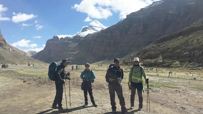
Tourists join a tour group on three days of the sacred Mount Kailash.
After that, you will take a journey to Gyirong is a chance to explore the snowy mountains and forests on the edge of the Himalayas. In Gyirong Town, at the Sino-Nepal border, you can visit Sherpa villages and get a glimpse of the traditional ways of life there.
Here, you can choose to continue your trip to Nepal or get back to Lhasa via Shigatse.
5. The Most Adventurous Way from Lhasa to Mt. Kailash is: Northern Route Via Namtso Lake
The north road from Lhasa to Mount Kailash makes a large roundabout in the northern part of Tibet through Nagqu and Ngari Prefectures. Among all those visitors who have explored this route, no one would not be stunned by the breathtaking scenery with wide visual fields, exquisite tranquil plateau lakes and kinds of wild Tibetan animals including Tibetan gazelle etc.
Here, we have divided the entire route into eight sections according to the road conditions and scenery.
1) Lhasa - Damxung - Namtso (250km; Perfect Asphalt-paved Road)
The asphalt paved road ensures unimpeded traffic from Lhasa to Namtso Lake. You will visit Tibet's second-largest magnificent lake and China's third-largest saline lake.
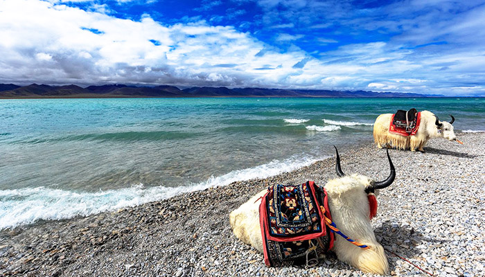
Yaks lying leisurely and enjoying the summer refreshment by the Namtso Lake
2) Namtso Lake - Baingoin (197km; Gravel Paved Road)
The road from Namtso Lake to Baingoin is under construction, making this section of the road muddy on rainy days while sending clouds of dust and debris in the air during sunny days. So, the bumpy road requires more skilled driving. Yield your steering wheel to the more skillful driver if you are not confident about your driving skills.
3) Baingoin - Nyima (335km; Gravel Paved Road & Grassy Land with Forks & Shortcuts)
The road from Baingoin to Nyima is dominated by gravel and debris. Some sections are meadows with boundless grassland, and only the vehicle tracks point the heading way. Magnificent plateau lakes and fresh grassy marshland are along the whole journey.
4) Nyima - Wenbu South Village (130km; Unsurfaced Dirt Road with Vehicle Tracks)
The road from Nyima to Wenbu South Village is sometimes straight and sometimes curved, with no fences but the vehicle tracks. Grassland stretches as far as the eye can see while the boundless prairie extends in each direction to the horizon.
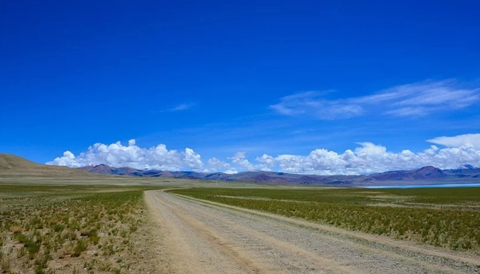
The gravel-paved road is lined with boundless grassland.
5) Wenbu South Village - Coqen (250km; Mostly Gravel Paved Dirt Road)
Road conditions from Wenbu South Village to Coqen are not as ideal except for the 20 km of paved road. Dirt and gravel roads make it even harder to drive when rainfall occurs. Water gathers on the road surface and makes it muddy when the rain comes.
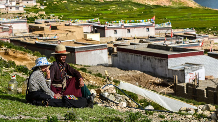
Local Tibetans are appreciating the glamorous sunset on the hillside of Wenbu South Village
6) Coqen - Ringtor (320km; Gravel Paved Road with Pits; Some Unknown Swamps)
During the entire journey, road conditions are not that complicated, but there are some swamps where vehicles can get temporarily stuck. Most of the sections are still gravel-paved dirt roads.
7) Ringtor - Yagra (97km; Gravel Paved Dirt Road)
Areas in this section are mainly uninhabited zones with dirt roads and unknown signs, making it easy to get lost. Try to follow the deep car tracks and drive at a comparatively slow speed. Also, try passing this section of the road in the company of other cars. And try to pick a four-wheel drive with a high-powered engine.
8) Yagra - Hor - Darchen (253km; Rough & Bumpy Gravel Road; Corrugated Road)
The road approaching Kailash from Yagra to Darchen through Hor is rough and bumpy. On sunny days, dust often blows into the sky as you pass by. On rainy days, the road turns to mud. Try driving on the comparatively smooth surface to avoid having your tires punctured.
6. The Fastest Way from Lhasa to Mt.Kailash is by Flight: Only Two Hours
Besides the two legendary overland routes to Mount Kailash, there is also a flight route from Lhasa to Ngari Gunsa Airport, which lies 60 km from Shiquanhe Town of Ngari Prefecture.
It is the closest airport to Mount Kailash, which is around 200 km to Darchen at the foot of Mount Kailash. The road in this section is an ideal national highway, so the drive is very smooth.
Since the flight from Lhasa to Ngari only takes around 2 hours, it is the fastest way to get to Mount Kailash from Lhasa.
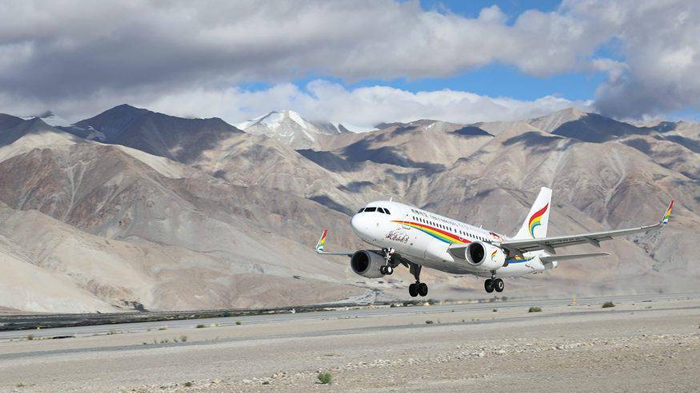
Ngari Gunsa Airport is the closest airport to Mount Kailash.
However, considering the abrupt rise of altitude, you are not recommended to take a flight directly to Gunsa Airport from Lhasa and continue to take a drive to Kailash. Not taking time to acclimatize to the altitude can easily cause you to suffer from acute altitude sickness.
Also, there is no stunning scenery along the route, and you would miss the world-class attractions from Lhasa to Everest Base Camp.
Conclusion
Mount Kailash is located over thousands’ kilometers away from Lhasa. The southern route via EBC is the best choice for tourists who prefer a Mount Kailash tour from Lhasa by land, with magnificent scenery along the way and perfect asphalt-paved roads. While the north route is also recommended if you are seeking exotic scenery and adventurous experience.
Besides, you can also take a flight to Ngari airport and then take a short drive to Kailash, when your travel time it limited.
If you have more question about travelling from Lhasa to Mount Kailash, please feel free to contact us or leave your comment below.


35 Comment ON "Lhasa to Mount Kailash: Distance, Road Condition, Best Way to Go"
Asked by Liliana Me** from Macau
plan a 7-8days trip for me and my boyfriend in April
Hi! I would like to plan a 7-8days trip for me and my boyfriend in April (3rd to 10th ideally) to Nepal, Tibet, and, if possible, Bhutan. Do you think it would be doable? Based on what I read, there are some places/things to do to consider: Nepal: Everest Base Camp trek and the Annapurna Circuit, ancient temples, sacred sites like Lumbini, Kathmandu, Tibet: The Potala Palace in Lhasa and the Jokhang Temple. eventually the holy Mount Kailash or the high-altitude plains. Bhutan: Thimphu, Paro, and the famous Tiger’s Nest Monastery. To take part in cultural traditions, yoga, meditation... Of course I am open to any recommendations you could make. For your reference, we are both based in Asia: him, in Bangkok and myself in Macau. Thank you so much for the information you could provide and, if possible, an estimated budget for your offer.
Asked by Ke** from Singapore
Cycling Tour to Mt Kailash
Hi , we are planning a Cycling Trip once Tibet opens for Tourism. The plan is we shall arrive to Kathmandu , travel to the border and enter via Kerung. Can you pls send a day to day Itinerary starting from Kerung - Lake Manasarovar - Darchen - Asthapath. We shall go around Kailash on foot and resume Cycling back to Kerung. We are a Group of 6-8 persons. Thanks Pls send ur reply to Kevin
Asked by Debo** from USA
Please can you tell me the prices and dates for the Tibet Luxury Tour.
Also, could you please provide a detailed itinerary - I want to see how many hours are spent on buses/vehicles. Thank you! Deborah
Asked by S** from HongKong
Tibet Tour from HK
May I know if holding Mainland Travel Permit for HK Residents. is it also need to get the visa permit to Tibet and what is the procedure if need to apply? Thank you
Asked by Na** from USA
Is Kailash Mansarovar Trip open for Indian Passport Holder?
Is it open for Indian Passport Holder?
Asked by A** from Singapore
Enquiry on private tour
We are planning a trip from Hong Kong to Tibet during the 12th to 21st of April. We want a private tour that covers all the scenic places as well as the EBC. Please advise an itinerary along with the cost breakdown. Thanks.
Asked by Na** from Canada
We would like to take the train from Xining to Lhasa
Asked by Gr** from Canada
The "Tibet Entry Permit" should be apply
Asked by Tam** from Singapore
Sightseeing Potala Palace
Asked by Ka** from Singapore
plan to travel to Mount Kailash